
Hello Lockdown Lovers, this is the time of year when we would normally be working along the Ravensbourne river catchment, up and down the rivers Quaggy, Ravensbourne and Pool, along with their associated feeder streams. We would be running clean ups, removing invasive flora such Himalayan Balsam and Giant Hogweed and generally sunning ourselves. Therefore, over the next week I will be putting together a virtual tour of the catchment, starting with the River Quaggy.
The river Quaggy rises, as the Kyd Brook, within Ninehams Wood, a privately-owned woodland just S of the village of Locksbottom on the Kent/London borders.

Near the source of the Quaggy, as the Kyd Brook, at Ninehams Wood, with Pamela Zollicoffer and Mike Keogh of the Quaggy Waterways Action Group (QWAG)

LBC just downstream of Ninehams Wood, viewing the Kyd Brook as it passes under the A21.
The river proceeds underneath Locksbottom village to Tugmutton Common and Farnborough Recreation Ground, where the breadth of the watershed becomes apparent with a number of first-order streams gathering to become second-order streams as they develop into the Kyd Brook proper within Gumping Common. Gumping Common, Sparrow Wood and Crofton Heath form one great SSSI just S of Petts Wood.

Gumping Common. LB of Bromley. Very flashy with plenty of storm damage (Kyd Brook)


Kyd Brook through Petts Wood
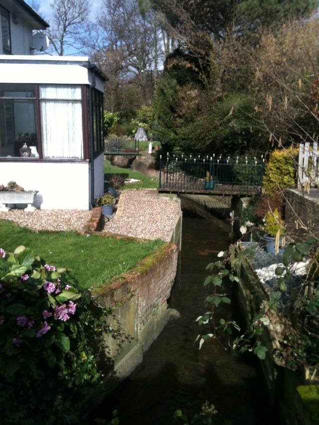
Through this section it is mostly culverted into a tight channel and every so often, while passing through privately owned gardens, it is toe-boarded and the gardens themselves become its floodplain, and it often floods here. It is some relief, therefore, that once through this congestion it can breathe again when it crosses the railway into National Trust Pettswood, on the Hawkwood Estate.

The Kyd Brook as it runs through NT Pettswood, on the Hawkwood Estate, near Chislehurst
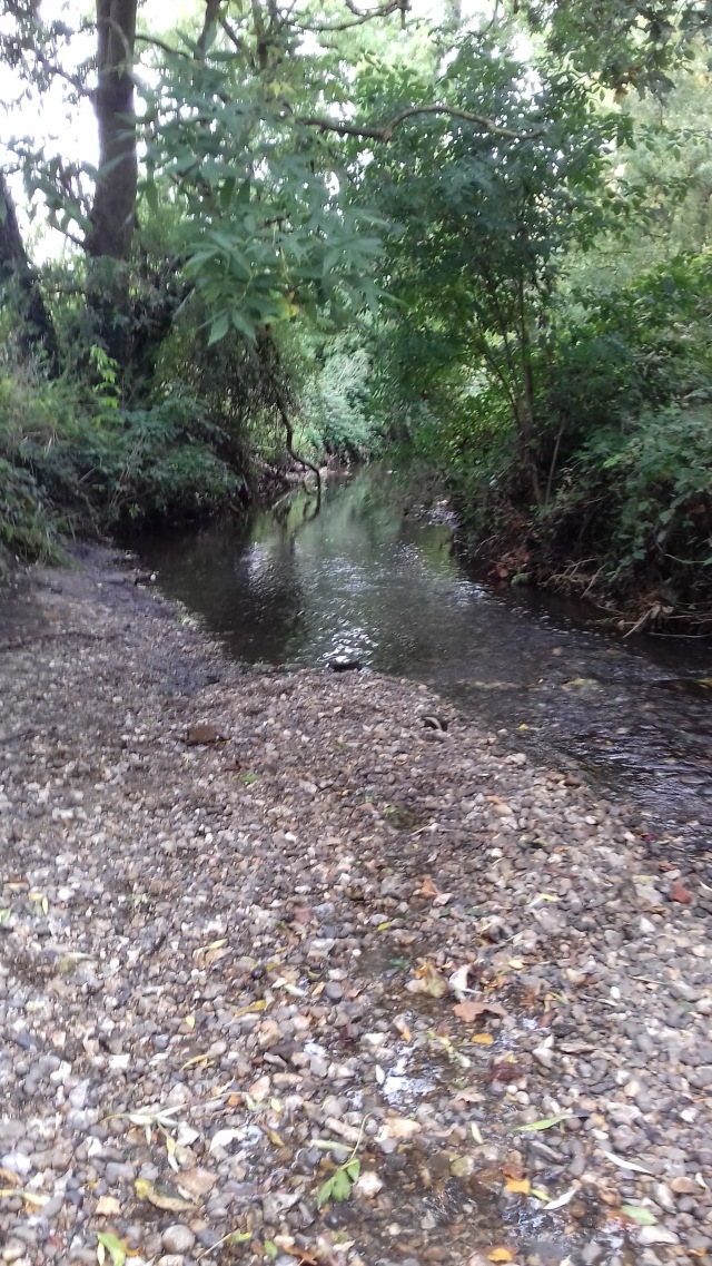
Kyd Brook at NT Pettswood
As the river heads toward the A222 and Chislehurst Station it moves into an elaborate trash screen and hi-flow escape channel, this is managed by the Environment Agency.

EA trashscreen nr. Chislehurst Station on the Kyd Brook
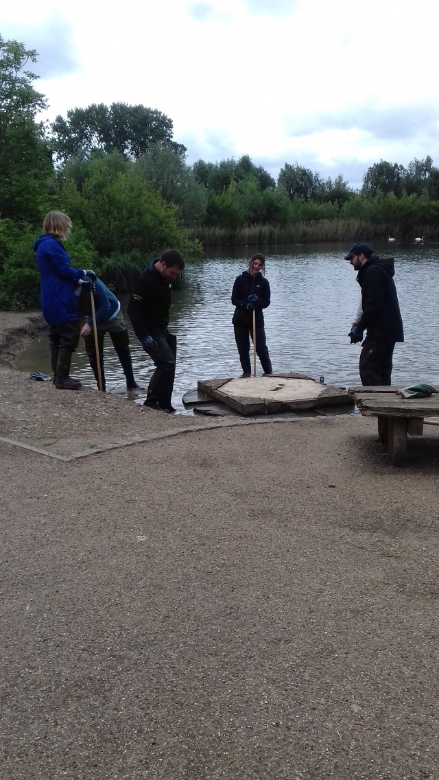
From here it moves NW and soon it is within Sundridge Park Golf Club, a large heavily managed greenspace. It is here that the Kyd Brook becomes the Quaggy, as the Milk Ditch to the W joins in. After more underground shenanigans the river enters Chinbrook Meadows, the first of the Quaggy’s restoration successes. In 2002 the river was broken out of it’s concrete overcoat and freed, after great work by the Quaggy Waterways Action Group (QWAG). The S section of the park is owned by Bromley but managed by Lewisham, it is here that the proposed Thames21 Chinbrook Rainscape Project will take place, re-directing the polluted Grove Park Ditch into a series of filtration ponds.

Dr Nathalie Gilbert tests the Grove Park Ditch waters.
Under the railway bridge is the N section, owned and managed by Lewisham.
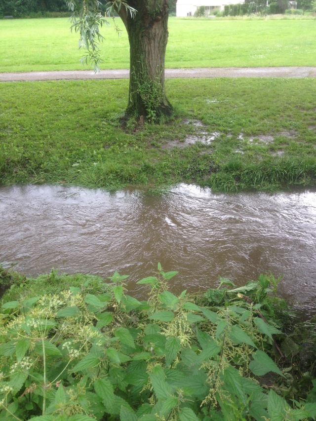
Quaggy in spate at Chinbrook Meadows

Lewisham volunteers in Chinbrook: l-r Chris, Jess (LB of Lewisham), Jane and Ray.
Quaggy at Chinbrook (with Judith Watling of Glendale)
The Quaggy flows straight N from here and bypasses Sydenham Cottages and the City of London School Sports Ground to enter the start of a huge area of opportunity. To QWAG this is part of the Quaggy Links proposal, where non-accessible banking and disused woodland is made accessible with walkways and cycle paths and therefore a link may be created toward Sutcliffe Park in the N.

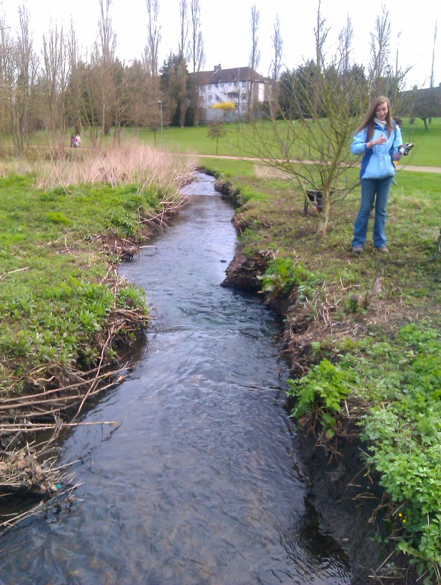
Quaggy along Mottingham Lane during the 3 Rivers Clean Up.
The Quaggy crosses Winn Road and Mottingham Lane into a beautiful, tight, naturalised section where natural processes are allowed to take place. Many unnatural processes take place here too, such as fly-tipping and scooter dumping, making the annual 3 Rivers Clean Up such an important effort by local volunteers.
As the river moves through this section, and stares the A20 in the face, the Little Quaggy joins from the East. With its origins up by the Tarn in Eltham, this is another river with both problems and opportunities. Problems because often polluted water joins the river by way of run-off from the A20 and also the much-troubled feed into and out of the Eltham Pleasance lake at the Tarn.

Thames21’s John Bryden, Pete Ehmann from the EA and Nick Pond from Lewisham Council inspect the Tarn.

Chris Stafford negotiates the Little Quaggy.

Quant Hogweed along the Little Quaggy
The opportunities along the Little Quaggy lie with the Natural Flood Management potential of the site, with riding paddocks on one side and a beautiful wild flower meadow on the other. After the confluence of the Quaggy and the Little Quaggy, the river proceeds through a lengthy culverted section, incorporating other potential break-out sites at Colfe’s School playing fields.

Outfall Safari team move through Colfe’s playing fields.
This section is about 800m in length before it hits the EA trash screens at Horn Park and then Sutcliffe Park. Sutcliffe Park itself used to be a series of football pitches, with the river in dilapidated Victorian pipe underground. It was here in 1984 that I played right-back for the Press Association against the Guardian on a very muddy pitch, we lost 10-0.
In 2004, the Quaggy was restored above ground, in a hugely ambitious Flood Alleviation Scheme, that would protect residential Lee, Hither Green and Lewisham. Following much persistence by Matthew Blumler of QWAG, this project, that was doubted by many, was brought to fruition and has been an outrageous success, with the resulting riparian greenspace one of the best for wildlife in Sth East London.

Chris and Vic, and one of Vic’s boys, in Sutcliffe Park.
Re-positioning the bird platform at Sutcliffe Park during an EA day out. Remember, these used to be football pitches and everything you see has arrived post-2004.
The Lower Kyd Brook and the Well Hall Stream both enter the Quaggy’s additional underground overflow culvert as it moves through the park and they all outfall together through the John Roan Sports Field and head N towards Weigall Road. As it meanders through sports fields and commonland, the Quaggy reaches a large EA pinch-point structure, an engineered flood management facility aimed at snagging any large items of wooded debris. This is intended to deflect the river waters over into open ground when in flood.

The EA pinch point as the Quaggy heads towards Lee.

OK then, the river flows toward Manor House Gardens
The river continues North into an area of heavy residential development, through Lee, Hither Green and Lewisham. While the river at this point has semi-natural banking, it is bordered by buildings and gardens with two more greenspaces before it reaches Lewisham, Manor House Gardens and Manor Park, the latter restored in 2006.

QWAG chair Paul de Zylva with volunteer clean up crew

QWAG crew admire a reclining Mike at Manor House Gardens.
From Manor House Gardens the river continues through, skirting Hither Green, into Manor Park.

Chris Stafford carefully demonstrates how you deal with Giant Hogweed, with fellow invasive plant, the Himalayan Balsam, in the foreground.

Joe Pecorelli of ZSL demonstrates kick-sampling to the Ravensbourne Riverfly (RMI) team at Manor Park. The RMI project has been running successfully in the catchment for a number of years and allows us to monitor water quality via the freshwater invertebrate population.

Ravensbourne Riverfly team, training at Manor Park

Just N of Manor Park, Himalayan Balsam on the Quaggy.
The Quaggy deflectors, as it runs behind the properties at Gilmore Road, SE13.
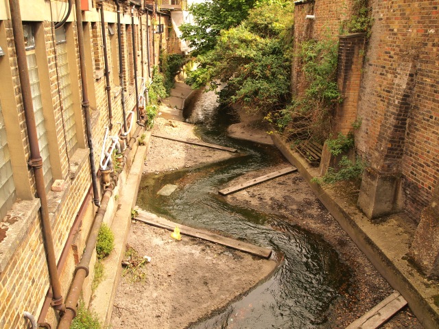
The Quaggy leads away from Manor Park in a fairly naturalised state, bordering residential back gardens on one side and then supermarkets etc on the other. At Gilmore Road it goes underground again, under Europe’s largest Police Station, and out into the Lewisham Gateway development, where it was recently re channeled to accommodate more hi-rise development. The new substrate has actually been glued together for aesthetics, thanks developers! Here is the old version…

Quaggy (L) meets the Ravensbourne just north of Lewisham centre. My preferred view of the rivers. I like the British Rail brickwork.
There you are, I hope you’ve enjoyed this brief intro to my fave London river. Of course there maybe omissions, mistakes, etc, but this is a little foray into our catchment.
Next up: The Ravensbourne…….
For more reading on the River Quaggy go to the QWAG website: HERE
For a near complete set of films I made for QWAG, led by Matthew Blumler, go HERE
Lawrence Beale Collins ran the Ravensbourne Catchment Partnership from 2014-18 and has worked along these river for a decade, for most of that time with river charity Thames21. He was born in Lewisham and grew up next to the Ravensbourne’s source. He now lives near the confluence with the Thames.

Interesting read. Thank you.
LikeLike